The Icelandic Meteorological Office published a new long-term lava hazard assessment for the Reykjanes Peninsula and the greater capital area on 21 April 2026. The report identifies Grindavík and Hveragerði as sitting within the highest hazard category — the top 10% of areas most exposed to lava flow risk and eruptive fissure probability. Parts of Hafnarfjörður, particularly those close to the Krýsuvík volcanic system, also fall within elevated to high-risk zones. The assessment is a planning document based on geological history and probabilistic modelling; it does not predict imminent eruptions or specific access changes.
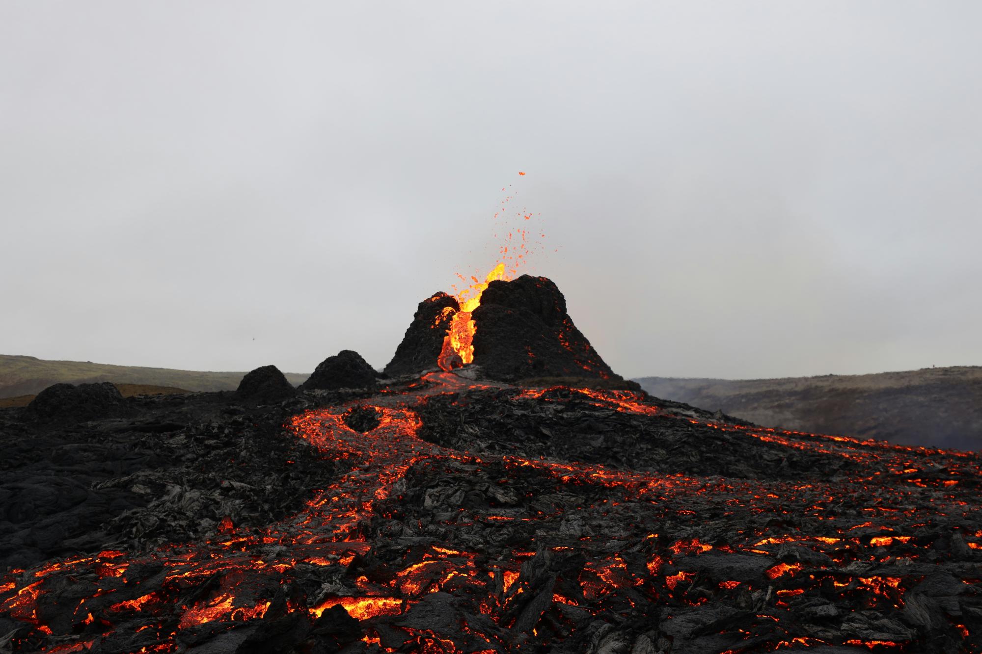
Why this matters for photographers: Grindavík and the surrounding Reykjanes Peninsula have become a major destination for eruption and lava field photography since 2021. The new maps formalise what volcanic activity since then has made visually clear: the area around the Sundhnúkur crater row, Svartsengi, and Grindavík itself carries sustained, long-term volcanic risk. Hveragerði, a popular base for photographers visiting the South Coast and geothermal areas, now sits in the same high-risk category. While the assessment does not create new access restrictions, it reinforces that photography in active volcanic zones on the Reykjanes Peninsula requires constant awareness of current hazard status. As of 22 April 2026, the IMO’s eruption hazard assessment — updated on 15 April and valid through 6 May — confirms magma continues to accumulate beneath Svartsengi, and another eruption along the Sundhnúkur crater row remains a realistic near-term possibility.
What photographers should do:
- Always check the current IMO volcanic hazard map at en.vedur.is before visiting the Reykjanes Peninsula — hazard zones and access restrictions can change within hours if eruptive activity resumes.
- Follow all closures and exclusion zones around the Sundhnúkur crater row; these are set by civil protection authorities and are not optional.
- Use the new lava flow hazard viewer at www.eldfjallava.is to understand the risk landscape around any specific Reykjanes location you plan to photograph.
- Do not approach active or recently active lava fields without authorised guided access — gas hazards and unstable crusts are ongoing risks even when no eruption is visible.
Leave No Trace note: Fresh and recent lava fields on the Reykjanes Peninsula are scientifically significant and ecologically active. Stepping off established paths damages the fragile surface crust and disturbs early biological colonisation. Stay on marked routes at all times.
For full guidance on photographing Iceland’s volcanic landscapes safely and responsibly, see our Photography in Iceland: The Complete Responsible Guide.
Source: Iceland Monitor (mbl.is English) — https://icelandmonitor.mbl.is/news/nature_and_travel/2026/04/21/two_towns_fall_in_the_top_tier_of_lava_risk_in_new_/