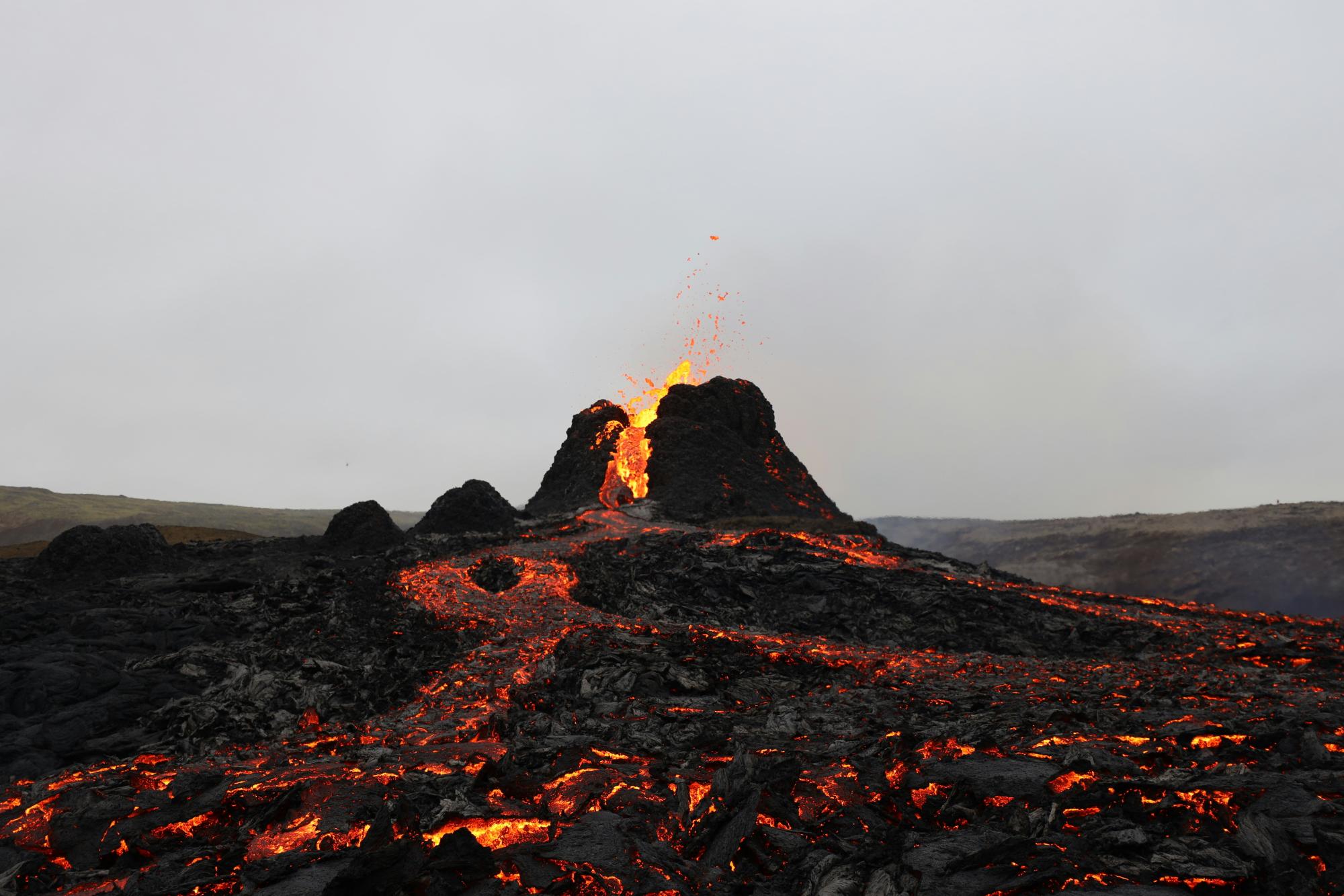
The Icelandic Meteorological Office reports that magma accumulation beneath the Svartsengi volcanic system on the Reykjanes Peninsula has now exceeded 25 million cubic metres — the highest volume recorded between eruptions since this eruptive cycle began in November 2023. Ground uplift continues at up to 2 centimetres per month, and the IMO’s hazard assessment, currently at Alert Level 2 (Orange — Heightened Unrest), remains in effect until 30 June 2026. The last eruption in this series ended on 5 August 2025.
Why this matters for photographers: The Reykjanes Peninsula — including the lava fields around Svartsengi, Grindavík, and the Sundhnúkur crater row — is one of the most popular landscape photography destinations in Iceland. The IMO notes that if a new eruption begins, warning times may range from as little as 20 minutes to just over four hours. Photographers who plan to visit the peninsula for coastal, lava, and volcanic landscape work need to be aware of this compressed warning window. The Blue Lagoon area sits within the broader hazard zone, and access to specific sites near Grindavík remains subject to rapid change.
What photographers should do:
- Check the IMO’s 24/7 hazard monitoring page (en.vedur.is) and the Safetravel.is eruption page before and during any visit to the Reykjanes Peninsula.
- Sign up for Safetravel alerts or follow the IMO on social media to receive real-time eruption warnings — do not rely on being told in person if you are shooting in the field.
- Keep your vehicle pointed toward a clear exit route when shooting in the lava field areas near Grindavík or Svartsengi, and note the nearest road back to Route 41 or Route 43.
- Avoid the immediate surroundings of the Sundhnúkur crater row and do not enter any area that is fenced or signed as restricted — new fencing may appear with little notice ahead of or during an eruption.
Iceland’s volcanic landscape is one of the world’s great photography subjects, and visiting during a period of elevated activity can be safe with proper preparation. The key is real-time information, not assumptions based on conditions from a previous visit. Authorities provide clear, regularly updated guidance — use it.
For full guidance on safe access to the Reykjanes lava fields, see our Iceland F-Roads for Photographers: Access, Safety & Seasons.
Source: Icelandic Meteorological Office (Veðurstofa Íslands) — https://en.vedur.is/about-imo/news/earthquake-in-brennisteinsfjoll-faster-subsidence-in-krysuvik-and-continued-magma-accumulation-at-svartsengi